8:40 p.m. update: Aircraft on the Elephant Hill fire were unable to fly today due to smoke, says Heather Rice, Fire Information Officer for the Elephant Hill fire.
“The visibility was really poor. On the upside, that does help cool the temperatures a little bit to make doing the ground work a little bit easier, but other than that most of the work done today would have been on the ground, doing hand guards and heavy equipment guards. I think they had some pretty good success with that. They’re building quite a significant guard along that north flank and are making good progress with that but they would have been not doing any air work today because of the extremely heavy smoke and poor visibility,” says Rice.
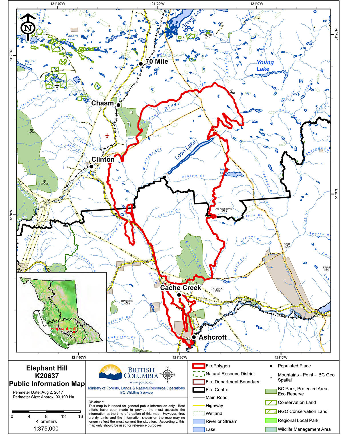
She says crews continue to work hard where fire escaped and jumped Highway 97 near the Loon Lake turnoff.
“I know the excursion to the south there, they’ve guards around a good part of it now using some of the natural terrain that’s there. There’s kind of two gulleys on either side of it that they’re going to try to hold it into and then they have a power line that they can use as a bit of a natural guard.”
Original story: The Elephant Hill fire is now estimated at 93,100 hectares, according to Fire Information Officer Heather Rice. The growth has been mostly in the north east towards the Young Lake area, the fire that jumped the Highway 97 near the Loon Lake turnoff and more accurate mapping, she says.
“The real head of the fire, we haven’t been able to put guards in yet… We did have quite a successful controlled burn in the north yesterday. The purpose of that again is as it’s always been to give us the upper hand on where the fire is going to burn. That is in the north towards Chasm Mill.”
The Fire Service is conducting controlled burns almost every day, says Rice.
“There’s always pockets of fuel within a fire that don’t burn. We’ll go in and burn those so that they don’t reignite and then maybe on a windy day spread the embers somewhere else. And then other areas, the controlled burns are actually outside the existing perimeter but we’re using those burns to bring the fire, as we say, to us.”
Related: “Every single one of us should be on alert”
The fire that jumped Highway 97 near Loon Lake was from a controlled burn.
“Most of the time it’s very successful. It worked great on the Gustafsen fire. That’s what we used on the Gustafsen fire to protect the West Fraser and Norbord sites. It’s actually happening every day and there’s always some risk with any kind of fire,” she says.
“A lot of science goes into it though, a lot of decision making, especially for larger controlled burns. We always have a fire behaviour analyst on hand. We have highly trained personnel who are looking at everything from the HR values, to the direction of the wind to the aspect, to the fuels, what is the fuel loading, how dry is it, which way can we try and predict the winds will blow,” she says, adding that controlled burns need winds that will draw the fire into the existing fire.
New area placed on alert
The Thompson-Nicola Regional District has placed an area along Highway 99 on evacuation alert.
The area includes three addresses along Highway 97, one along Highway 99 and two on Jackson Road. The full area can be seen on the map below.
The new alert was issued at 10 a.m. August 3.
The release says that families placed on alert should locate all family members and be prepared to evacuate their residence and property to an identified safe reception center; gather essential items such as medication, eyeglasses, valuable papers photographs and immediate care needs for dependents; prepare to move disabled persons and children; collect pets and pet needs; and if possible move livestock to a safe area.
For more information, or transportation assistance, residents are asked to call the regional district’s Emergency Operations Centre at 1-866-377-7188.